Tierrabuena maps, a powerful tool to innovate and transform the Colombian countryside
Interactive maps have become essential tools for data visualization and knowledge generation in different fields of knowledge and in diverse contexts. At the international level, governments, NGOs, and companies with a global impact on society apply this tool to provide meaningful and useful information to people.
During COVID-19, platforms such as Johns Hopkings University used maps to monitor vaccination, hospitalization and mortality rates, consolidating themselves as key tools for decision makers and the public. Similarly, maps have been instrumental in monitoring glaciers, global deforestation and national geoportals that provide topographic and geospatial information of territories.
Likewise, in the context of the agricultural world, particularly in Colombia, rural and urban producers interested in starting or continuing a productive project in the countryside face challenges such as the lack of information regarding soils, crops, climate change, among others.
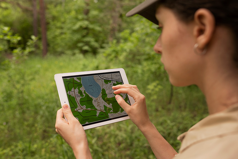
As a farmer, imagine being able to predict which crops will thrive on your land before planting a single seed or being able to explore different soil characteristics with up-to-date and practical data for effective decision making.
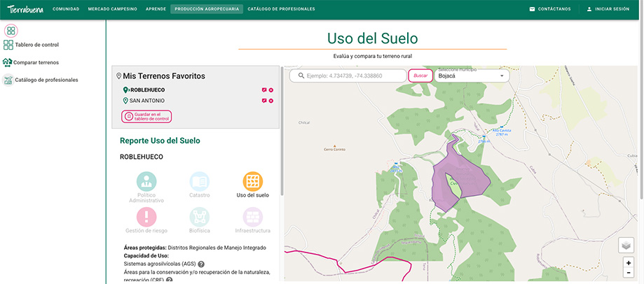
Today it is possible through Tierrabuena and its map module, which allows people to evaluate and compare land with potential for agricultural production and growth, in this case, in municipalities and rural areas of Agua de Dios, Bojacá y Topaipí.
With this tool, you can access diverse types of meaningful information for your rural project, including:
- Political-administrative information: To know the location, department, municipality, and district.
- Cadastral data: To know the plot size and its built area.
- Land Use data: To identify if the plot is located in a Natural National Park.
- Biophysics: Data on precipitation, forests, and geomorphology
- Risk management: Threats and natural phenomena.
- Infrastructure: Accessibility, connectivity, and public services.
Additionally, the Tierrabuena map offers comprehensive information on land suitability for various products such as avocado, cocoa, cachama, coffee, panela sugarcane, beef cattle, onion, beans, gulupa, dairy cattle, corn, mango, potato, fish, banana, among others.
This innovative solution has been built using the following advanced technologies:
MAPS API-Rest
- Leaflet: A JavaScript library for interactive maps.
- Laravel: As an open-source framework to develop PHP applications and web services.
- PostgreSQL: For storing soil use and geospatial data, including polygons, points, and attributes related to different map areas.
Digital platform
- Drupal: As a content management system.
- Vue.js: Specifically version vue3, a front-end framework for building interactive user interfaces.
- Vuetify: A UI component framework based on Vue.js for creating modern and responsive interfaces.
- JavaScript: Facilitates map interactivity, backend communication, and advanced functionalities like dynamic filters and data animations.
In this way, Tierrabuena represents a revolution in agricultural management in Colombia, transforming complex data into accessible and practical insights, through the integration of advanced technologies, democratizing information on land use and benefiting farmers and people interested in building a productive project in the countryside.
We invite you to get to know the countryside, to materialize your productive projects and strengthen agriculture, through our innovations and intelligent interactive maps. Sign-up in Tierrabuena.co or contact us to share your requirements over maps and digital innovation.
References:
- FasterCapital. (S.f.). Power of interactive maps for increased awareness and engagement. Retrieved January 13, 2025, from https://fastercapital.com/content/Power-of-interactive-maps-for-increased-awareness-and-engagement.html
- Johns Hopkins University. (n.d.). COVID-19 dashboard by the Center for Systems Science and Engineering (CSSE). Retrieved January 13, 2025, from https://coronavirus.jhu.edu/map.html
- Global Forest Watch. (n.d.). Interactive map for monitoring deforestation and forest change. Retrieved January 13, 2025, from https://www.globalforestwatch.org/map/
Keywords: interactive maps, PostgreSQL, Drupal, Vue.js, Leaflet, Tierrabuena, agriculture.